Specialty Equipment
Custom and Creative
We’ve invested heavily in specialty equipment so we can better serve you. Read on to learn more.
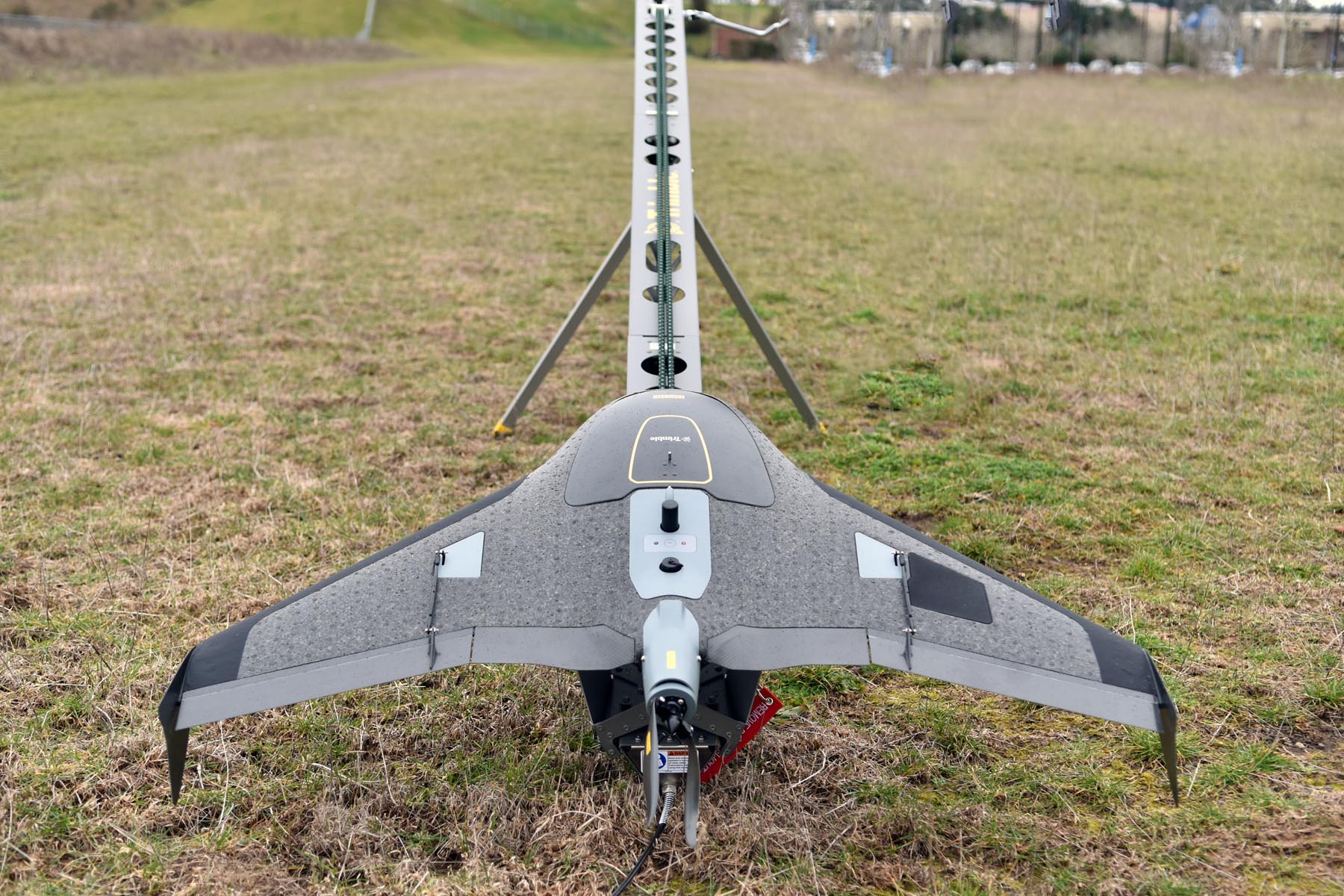
UX5 HP
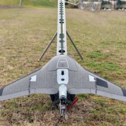
The UX5 HP is a professional grade aerial mapping system that captures high resolution photographs.
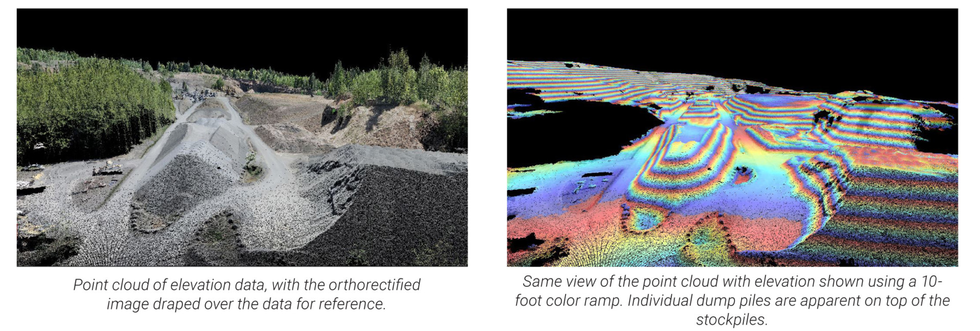
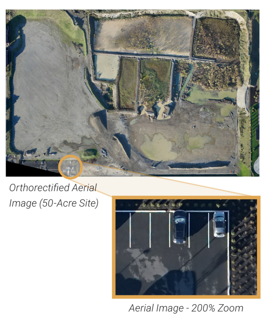
Our geological and mining consulting services are now augmented by the UX5 HP fixed-wing drone, or unmanned aerial system (UAS). The UX5 HP is a professional grade aerial mapping system that captures high resolution photographs. This system is well suited to rapidly collect aerial imagery and topographic information at large sites where traditional surveying techniques would not be effective or efficient. We can collect data from hundreds of acres in a matter of hours, making the UAS a very effective tool for mining and earthwork projects.
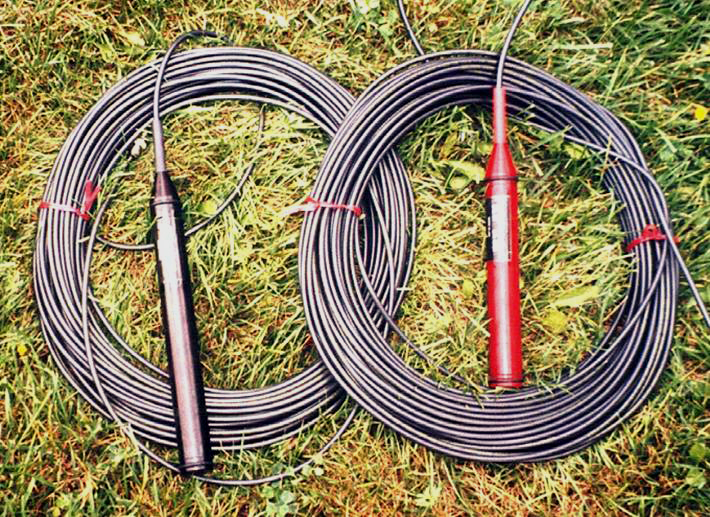
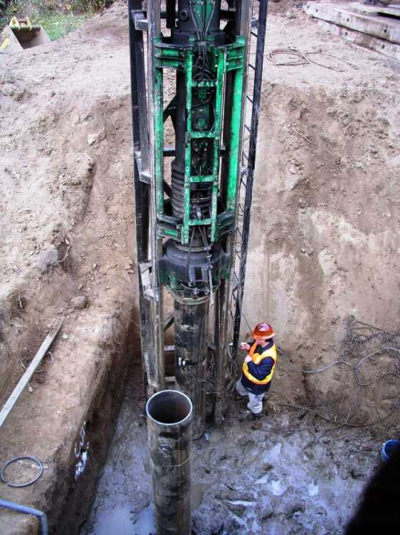
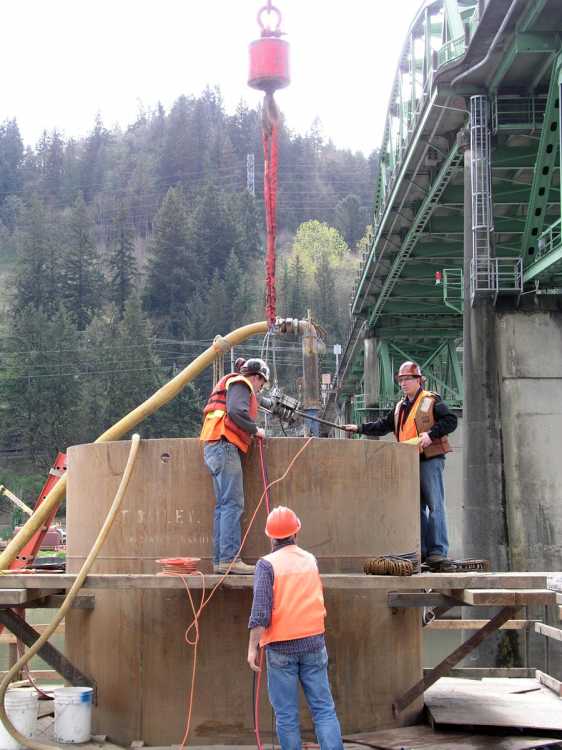
Crosshole Sonic Logging
CSL is an acoustic, non-destructive method that verifies the quality of drilled shafts. It involves lowering ultrasonic probes down access tubes in a drilled shaft. Recordings are made at depth intervals as the probes rise, and the ultrasonic pulses reveal any potential defects in the concrete.
Projects where we’ve used CSL testing include:
- I-5 over Coast Fork Willamette Bridge, Lane County
- Stafford and Borland Road Bridges over the Tualatin River, Clackamas
- Portland Aerial Tram
- The Casey (a 15-story condominium tower in downtown Portland)
- John Ross and 3720 (31-story condominium towers in the city’s South Waterfront district)

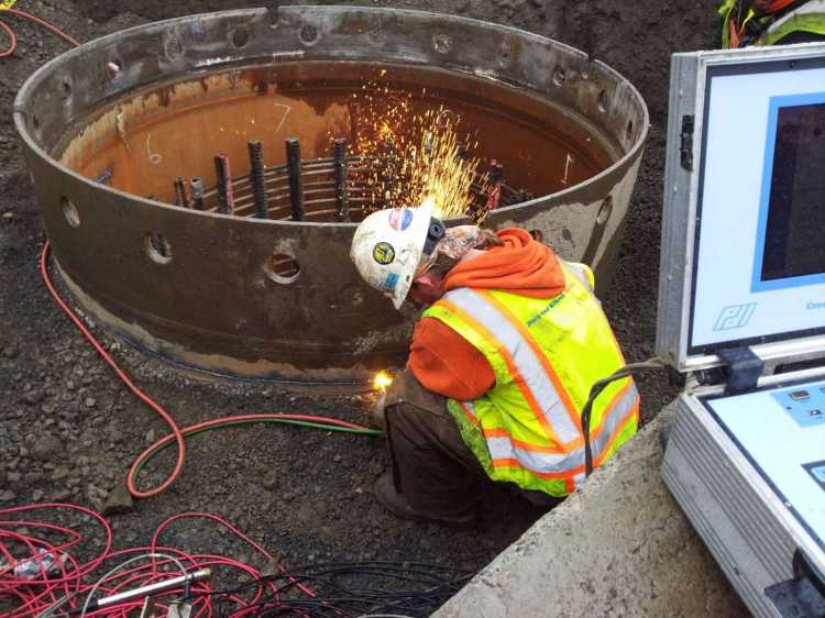
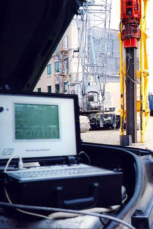
Pile Driving Analyzer
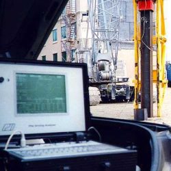
The PDA is a diagnostic tool for evaluating foundation pile systems and is the most widely used system for dynamic pile testing in the world. With the PDA, the capacity of several piles can be tested in one day for typically one-tenth the cost of a single conventional static test. The PDA measures the strain and acceleration of a pile under a dynamic impact, and evaluates shaft integrity, driving stresses, and hammer energy during pile installation.
Project highlights of our PDA testing services in Oregon include:
- The Civic (16-story condominium tower), Portland
- I-5 over Latham Road, Lane County
- I-84 over Mosier Creek, Hood River County
- West Baseline Road Bridge, Hillsboro
- Rivers Edge Development in Longview, Washington
Dynamic pile testing can significantly reduce the pile lengths, saving time and money.
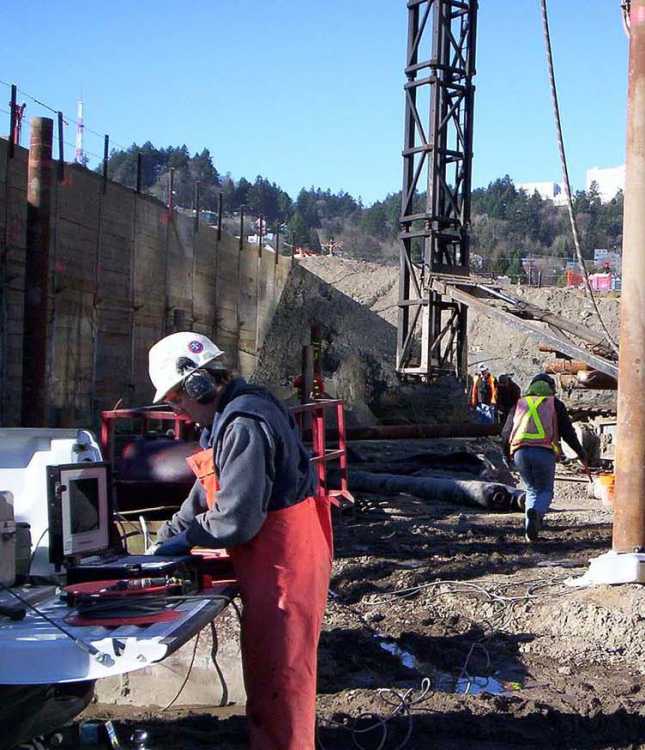
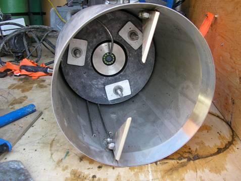
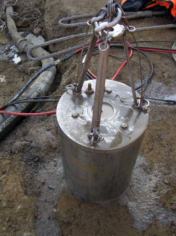
Drilled Shaft Inspection Camera
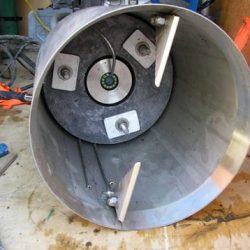
The Drilled Shaft Inspection Camera (DSIC) can observe the condition of the bottom surface of a drilled shaft and measure the amount of any sediment.
GeoDesign’s Drilled Shaft Inspection Camera (DSIC) can observe the condition of the bottom surface of a drilled shaft and measure the amount of any sediment. Our evaluation of this tip-bearing surface enables us to design high-capacity drilled shafts that can save time and money during construction.
Examples of this service include:
- Sauvie Island Bridge Replacement, Portland
- EVO (27-story condominium tower), downtown Los Angeles
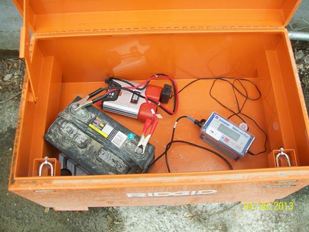
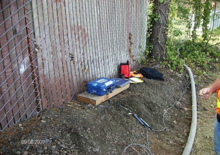
Vibration Monitoring
When structures are located near vibration-producing construction activities, GeoDesign can perform vibration monitoring to help protect against damage and associated claims.
When structures are located near vibration-producing construction activities, GeoDesign can perform vibration monitoring to help protect against damage and associated claims. Before construction, we document the condition of nearby structures and install crack-monitoring devices to establish a baseline condition. During construction, we can continuously record the peak particle velocity during a vibration event and produce a permanent record of the vibration.
We have performed vibration monitoring for projects that include the River Road Bridge and OR 217 Modernization projects in Washington County, Oregon, as well as several historic buildings in downtown Portland.
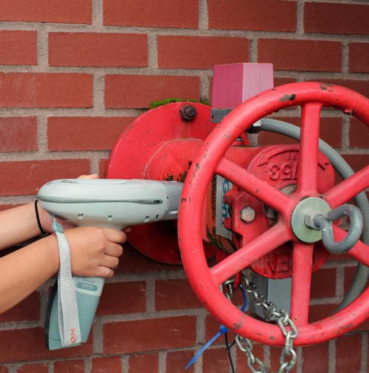
X-ray Flourescence (XRF) Meter
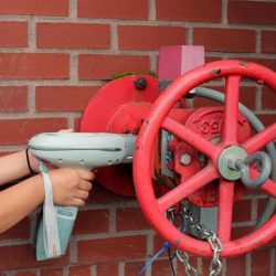
GeoDesign uses an x-ray fluorescence (XRF) meter to measure for lead in painted surfaces.
GeoDesign uses an x-ray fluorescence (XRF) meter to measure for lead in painted surfaces. This allows us to quickly test painted surfaces to see if high levels of lead are present, minimizing the need to collect paint chip samples. We can also test for lead in painted surfaces using the standard dust wipe sample method.
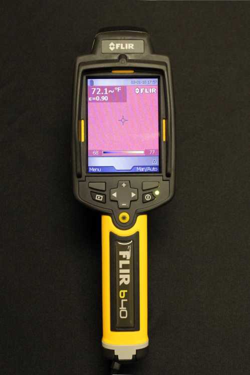
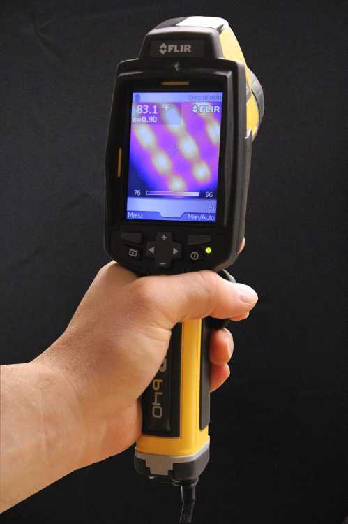
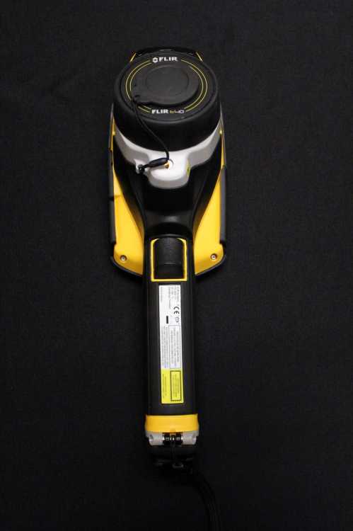
Infrared Mold Inspection Camera
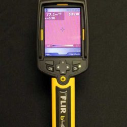
Our infrared mold inspection camera captures images and temperature readings and can easily document mold issues.
Our infrared mold inspection camera captures images and temperature readings and can easily document mold issues, including some not visible to the naked eye. Using the camera, we can cover large areas more quickly than we could with traditional methods.
Software

We use GIS software to manage and analyze geological, geotechnical, and environmental data.
We use GIS software to manage and analyze geological, geotechnical, and environmental data. Our computer network links our offices, and we maintain a wide range of analytical software used in embankment and retaining wall design.
Software includes:
- SlopeW
- XSTABL
- Plaxis
- GoldNail
- CT Shoring
- ProShake
- ArcGIS
- AutoCAD

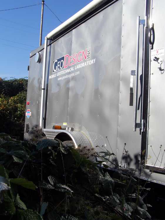
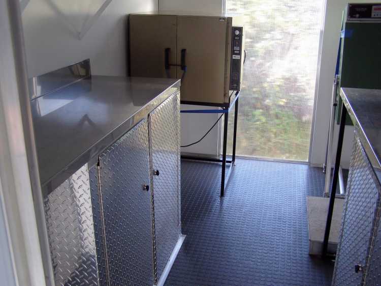
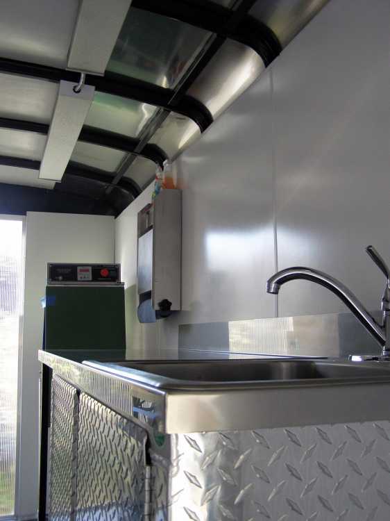
Mobile Geotechnical Laboratory
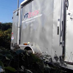
We can also provide geotechnical testing of soils on-site with our mobile laboratory, which offers the following benefits:
- Reduces special transport costs and chain of custody
- Mitigates handling risks and staff exposure
- Engineering oversight of testing and handling of contaminated soil
- Manages risk associated with testing soils containing asbestos
- Contaminated soil can often be returned to site for disposal