Hidden Portland
(or: Weird Things I’ve Learned about PDX because of My Job)
Before I came to work for GeoDesign, my knowledge of PDX was limited to awesome places to eat and Powell’s Books. And that’s not a bad place to start, but there’s a lot more to Portland than meets the eye.

I’ve learned a lot about the city our headquarters calls home through project research. This research informs how a geotechnical engineer or environmental consultant will approach a project site – and often, it unearths interesting things I’m not even looking for. It’s like having a secret – knowing that you’re standing on what used to be a lake, or that the movie theater you’re sitting in used to be a world’s fair exhibit hall.
So, without further ado, here are some random facts I’ve learned about PDX from archives, books, and (my personal fave) relentless Googling:
- A creek runs under it: Tanner Creek used to run through the whole of downtown, emptying into Couch Lake (between the Steel and Fremont Bridges). Today, it’s mainly in a system of pipes that runs under Providence Park and out into the Willamette. Looking for the creek in present day Portland? Some say they can hear it rushing under a manhole cover near Providence Park, but few people today have seen it with their own eyes. Tanner Springs Park is now located where the creek used to flow, an homage to the wetlands that used to dominate the Pearl District.
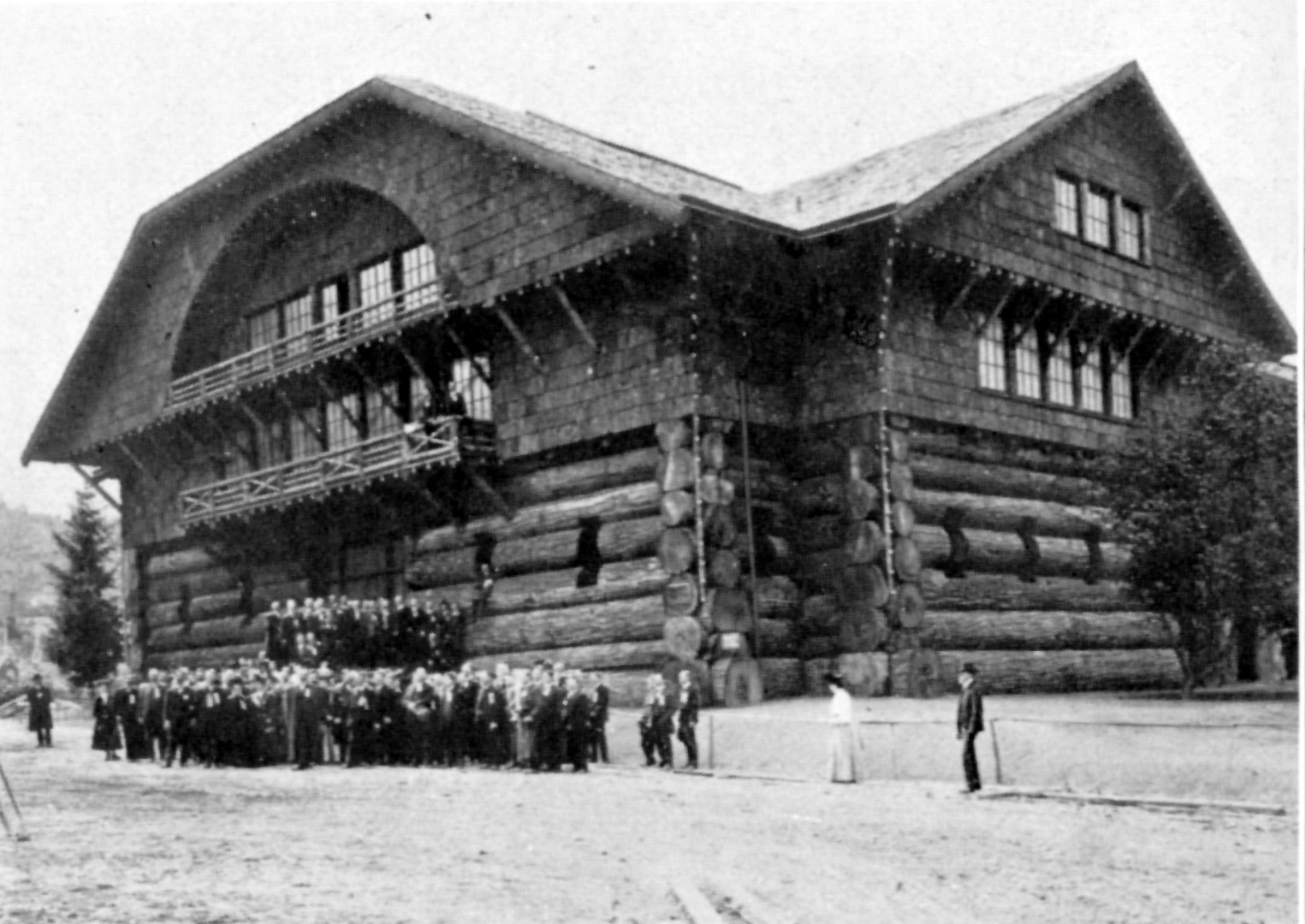
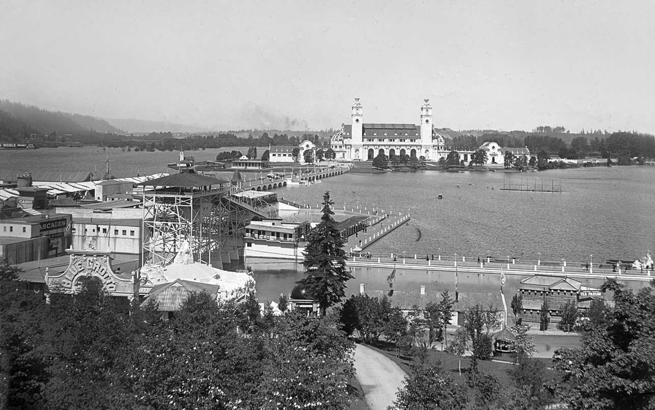
- Portland’s (only) world’s fair: The Lewis & Clark Centennial Exposition was in 1905, taking place around the edges of Guild’s Lake. Planners built a majestic, temporary city in what is now NW Portland. The lake itself was eventually filled, and the buildings either torn down, moved, or (tragically, in the case of the beautiful forestry building) burned. For a brief history and some incredible photos of a completely erased section of Portland, check out this article from the Oregonian.
- Speaking of Guild’s Lake, there was this guy who decided to fill it in without permission: Former congressman Lafe Pence saw Guild’s Lake as prime real estate for an industrial district, so he built flumes into the west hills and sluiced huge volumes of soil into the lake – without a right of way permits. As you can imagine, this went over well, and at one point the mayor actually sent police with axes to destroy one of the flumes. Eventually, however, the filling of Guild’s Lake was completed (without Pence), and became the industrial district he envisioned – just without any personal gain on his part. And yes, I’m glad you asked: you can hike the area where some of his flumes were.
- The street grid used to be a postal carrier’s nightmare: In “1891, there were twelve ‘A’ streets, twelve ‘B’ streets, twelve ‘First’ streets, nine ‘Cedar’ streets and so on,” according to Eugene E. Snyder, in “Portland Names and Neighborhoods: Their Historic Origins.” Why? After incorporating St. Johns, East Portland, and Albina, Portland found itself with a confusing network of duplicate street names. How long did it take for this to be rectified? It’s a long story, but basically, until 1931. Interesting side-effect: rumor has it there are older sections of sidewalk that still have these original street names stamped into them. I haven’t been able to find one yet, but I’m always looking for sidewalks that don’t match their street signs. And now you will too. You’re welcome – and happy hunting.
UPDATE: Thanks to Flickr user brx0 for sharing this pic of the old “Eastern” Avenue stamp in the pavement on SW 10th Street at Washington:

Credit: flickr user brx0

Check out our gallery below for some historic Portland – all images public domain, obtained from https://commons.wikimedia.org/.
Article by: Sarah Kelley